| Identifiant | ATLAS SOMME 14-18 N°1 - 2014 |
|---|---|
| Identifiant | ATLAS SOMME 14-18 N°1 - 2014 |
| Pays | France |
| Département | Somme |
| Nom | CHUIGNES |
| Autre appellation | N/A |
| Commune(s) | CHUIGNES |
| Coordonnées | 49°54’17’’N / 2°45’06’’E |
| OACI | N/A |
| Situation | 12 km sud-est ALBERT, sortie nord du village |
| Utilisation | Ancien aérodrome allemand 1ère GM |

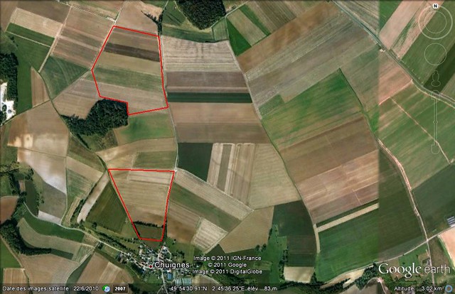
Limites des terrains Chuignes et Chuignes Nord (Jacques Calcine)
Occupation signalée en mai 1918 (27 à 30 tentes)
Sources :
SHD série A-160

